I woke up today without much of a plan of what I was going to do. After waking up, and doing a few things around the apartment, I noticed that there was actually sunshine outside. It wasn’t unqualified sunshine—there were dark clouds in part of the sky, and the forecast for the region called for thunderstorms to happen—but it was sunshine all the same.
It didn’t take long for me to hatch plans for a ride. I hadn’t really given my new speakers a test, yet. Nor had I really tested the highway pegs on a longer ride. After thinking about where I’d like to go, I decided I’d take a ride up to Hilton Head Island. Hilton Head is about 94 miles away from Statesboro by back roads. I checked the weather radar, which indicated I might hit some rain or thunderstorms along the way, but I didn’t care. It was time to go.

Above is the route I took. With the exception of US-278 approaching Hilton Head, it’s all quiet two lane back roads. There were many stretches where I didn’t see another vehicle, or anyone at all, for a half an hour at a time. The map is clicky, so you can look at the route more closely if you like… or change it into aerial photos, or…. well, you know the drill.

This photo is from after I had already crossed into South Carolina. I pulled over to try to get a shot of how conflicted the sky looked. I don’t think I really captured it, but the sky was always a mixture of clear blue and dark & stormy. On the way to Hilton Head, I hit a few pockets of really really light rain… while directly under blue sky. Usually just the windshield and the front of my shins would get wet. Everything would dry out within ten minutes each time.

Much of the trip was through quiet, abandoned back roads such as this one. I pulled over here to try to get a shot of a wild turkey in the road, but he ran away before I got the camera out. I was greeted by some other friends though….

There was a whole family of armadillos on the side of the road. Most of the pictures didn’t come out right, including the one of the armadillo-guy who came right up to my boot to say hello. These were the first live armadillos I had ever seen (being from Connecticut, and all) and apparently they were strange ones. There were 5 of them out together, in the middle of the day, and one came up to say hello. According to what I’ve just read, this is not usual. Maybe they knew that I didn’t want them for their tasty pork-like flesh. I prefer tofu.


A couple of shots of the beach once I made it to Hilton Head. I was the only guy walking up and down the beach in jeans and boots. Beach wear and bike wear don’t correlate too well. Who knew?
The temperature was about 79 degrees with a gentle breeze. It would have been a nice day to hang out there, if I had been properly equipped. Instead, I just got some strange looks.

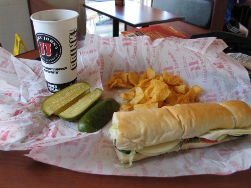
Before heading back, I grabbed some dinner at Giuseppi’s Pizza and Pasta, a restaurant decorated with a whole bunch of Pittsburgh sports memorabilia. There’s Steelers stuff, Pirates stuff, Pens stuff, and even some Pitt stuff. Apparently the owner was originally from Pittsburgh. I felt under dressed, having only my Buc’s cap to offer. Next time I’ll have to be sure to wear a jersey. At least I was able to get an Iron City with my pizza, though!

After pizza, it was time to head back. This photo, taken about here, shows that the sky was still a mix of clear and dark. Since it looked like I might be headed into some stormy weather, I decided to stop and put on the rain lining for the jacket as well as the visor for my helmet. While I did hit a few pockets of very light and brief rain, it was dry most of the way.
All in all it was a good ride. The speaker system gets high marks for its performance through out the ride. Both music and spoken stuff comes through pretty well. On the way up, I listed to the most recent episode of This American Life. It was almost entirely comprehensible, save a few short phrases here and there that were lost to the wind. Music comes through fine all the way up to 70, even on busy roads. I didn’t go much faster at any point in the ride, nor do I usually go any faster anyway, so it’s a win.
As it turns out, though, my 3rd G iPod only lasts about 3 hours on a full charge these days. for the last hour of my ride, I had to hook up the iPhone instead, which has a much more limited selection of music on it, currently.
All in all: great day, and a great ride.